
Nottinghamshire County Council has submitted plans for up to 550 homes, employment land, a new secondary school site and a pedestrian and cycle bridge over the A52 as part of the wider development proposed between Gamston and Tollerton.
The outline planning application covers approximately 61 hectares of county council-owned land within the East of Gamston/North of Tollerton strategic development area, which has been allocated for thousands of new homes.



The proposals also include land for at least eight Gypsy and Traveller pitches, sports facilities, allotments, public open space and new access roads connecting to the A52 and Tollerton Lane.
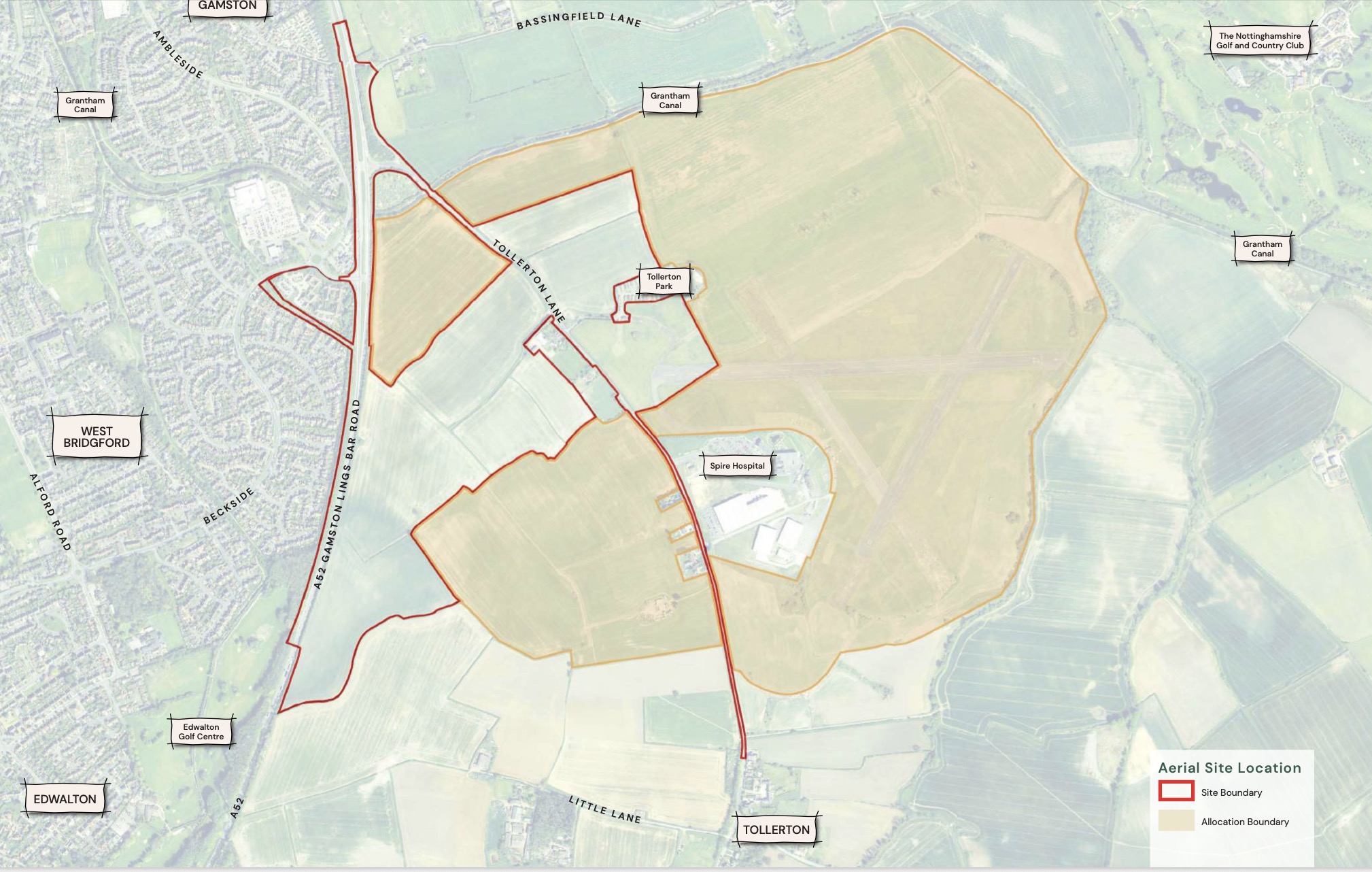
The application has been submitted to Rushcliffe Borough Council by planning consultants Pegasus Group on behalf of Nottinghamshire County Council.
According to the accompanying Planning Statement, the council’s proposals, together with two existing applications for neighbouring parts of the development, would bring the total number of homes proposed across the wider site to up to 4,400.
Those applications include proposals by Taylor Wimpey and Rockspring Barwood Gamston Ltd for up to 2,250 homes and a separate development by Vistry Homes covering up to 1,600 homes.
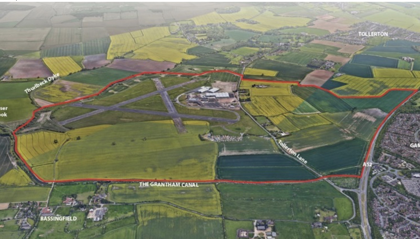
All three applications remain subject to planning consideration.
The county council’s application covers land alongside the A52, extending eastwards towards Tollerton Lane, and forms part of the wider strategic allocation that also includes the former Nottingham City Airport.
The proposed residential development would occupy approximately 16 hectares and accommodate up to 550 properties, including a mix of house sizes.
Up to 30 per cent of the homes, equivalent to 165 properties if the maximum number is built, would be affordable housing. The precise mix and tenure would be determined through later planning submissions and agreements.
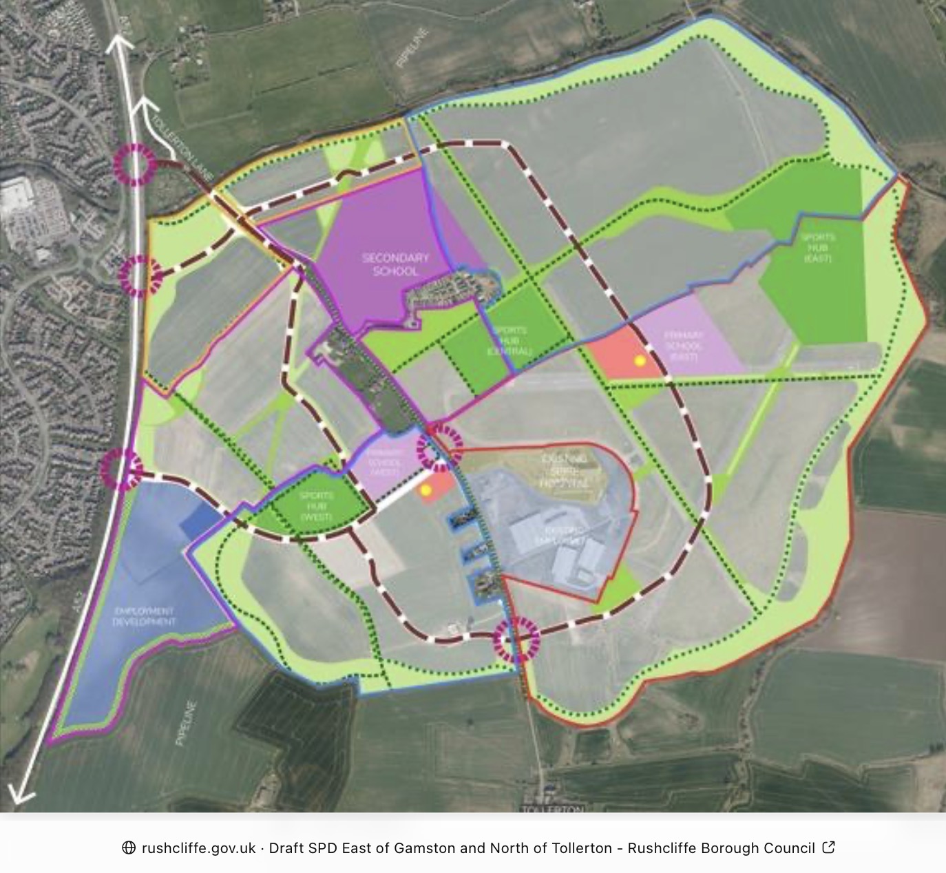
The proposals also set aside approximately 8.14 hectares for a secondary school and sixth form, positioned east of Tollerton Lane within the northern part of the application site.
The school is intended to serve the wider development, with its proposed location close to the main routes through the new neighbourhood and public transport connections.
However, the application seeks to establish the land required for a school rather than obtain detailed permission for the construction of the school itself.
Employment land would be concentrated towards the southern end of the site, alongside the A52. The application seeks permission for up to 12.3 hectares, with potential uses including industrial and manufacturing activities, storage and distribution, and associated offices.
A landscape buffer approximately 20 metres wide is proposed along parts of the western and southern boundaries of the employment area.
A separate 0.6-hectare site would accommodate at least eight Gypsy and Traveller plots, together with associated facilities and infrastructure.
Transport arrangements form a substantial part of the application.
The main residential area would be served by two vehicular access points, one from Tollerton Lane and another from the A52, connected by a new internal spine road.
Plans also include a pedestrian and cycle bridge across the A52, intended to provide a direct connection between the development, Gamston District Centre and West Bridgford via Beckside.
The bridge would form part of a wider network of pedestrian and cycle routes through the development, with connections to neighbouring development sites and existing public rights of way.
A footpath alongside Tollerton Lane is also proposed to improve pedestrian access and connections to bus stops.
The Design and Access Statement identifies more than seven hectares of open space and green infrastructure, incorporating landscaping, sports pitches, allotments, play areas, drainage features and pedestrian routes.
Existing trees and hedgerows would be retained where possible and incorporated into the proposed layout.
The site also contains historic Second World War pillboxes associated with the former Tollerton Airfield. Three Grade II listed pillboxes are located on county council-owned land and would need to be considered as part of the development.
The application follows Rushcliffe Borough Council’s adoption of a development framework and design code for the wider Gamston and Tollerton site in 2026.
In pre-application advice issued in March, Rushcliffe planning officers acknowledged that the combined proposals could accommodate up to 4,400 homes, although they said the supporting technical assessments would need to demonstrate that infrastructure impacts could be adequately addressed.
The Planning Statement submitted on behalf of the county council says transport assessments have been prepared on the basis of the wider 4,400-home development.
It argues that the proposed development can be accommodated without severe impacts on the road network, taking account of planned improvements to the A52.
These are the applicant’s conclusions and will form part of the evidence considered during the planning process.
The county council is seeking outline permission, with detailed approval requested for site access arrangements. Other matters, including the final layout, appearance, landscaping and detailed building designs, would be considered through subsequent reserved matters applications if permission is granted.
Rushcliffe Borough Council has yet to determine the application.
