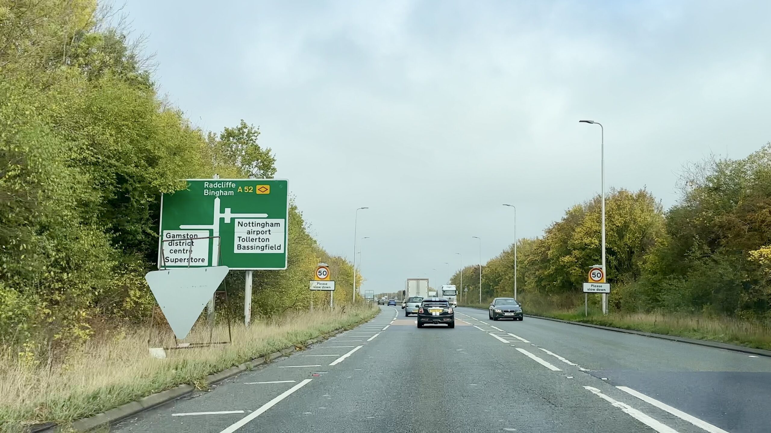
Plans for around 1.4 kilometres of A52 dualling, three major junction changes and new traffic management measures in Tollerton and Bassingfield have been detailed in a transport assessment supporting the proposed Gamston and Tollerton development.
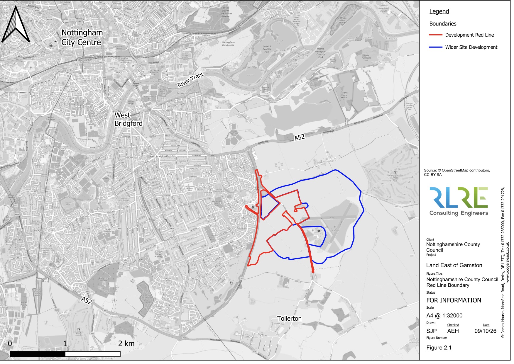
The assessment, submitted with Nottinghamshire County Council’s latest planning application, examines transport arrangements for the wider development of up to 4,400 homes to the east of Gamston and north of Tollerton.



Proposals include a new signal-controlled junction on the A52, changes to the existing Tollerton Lane junction, a new roundabout at Ambleside and a pedestrian and cycle bridge linking the development with Gamston.
There are also proposals to extend existing Nottingham City Transport bus services, introduce new walking and cycling routes and implement measures intended to discourage drivers from using surrounding villages as shortcuts.
The October 2026 Transport Assessment was prepared by Rodgers Leask on behalf of Arc Partnership and Nottinghamshire County Council.
It accompanies an outline application for up to 550 homes, employment land, a secondary school site and other facilities on county council-owned land.
However, the transport modelling considers the cumulative effects of three separate planning applications covering the wider Gamston and Tollerton development.
According to the assessment, the A52 between Gamston and Wheatcroft would undergo significant changes to accommodate traffic generated by the new development.
These include approximately 1.4 kilometres of dualling, alongside a new signal-controlled T-junction providing access to the county council’s land towards the southern end of the development.
The new junction would incorporate carriageway widening, pedestrian and cycle crossings controlled by traffic lights, and a shared-use route along the western side of the A52 towards Ambleside.
Further north, the existing A52 junction with Ambleside would be replaced by a four-arm, traffic-light-controlled roundabout.
The existing junction between the A52 and Tollerton Lane would also be upgraded with traffic signals.
Together, these would provide three principal access points from the A52 into the wider development.
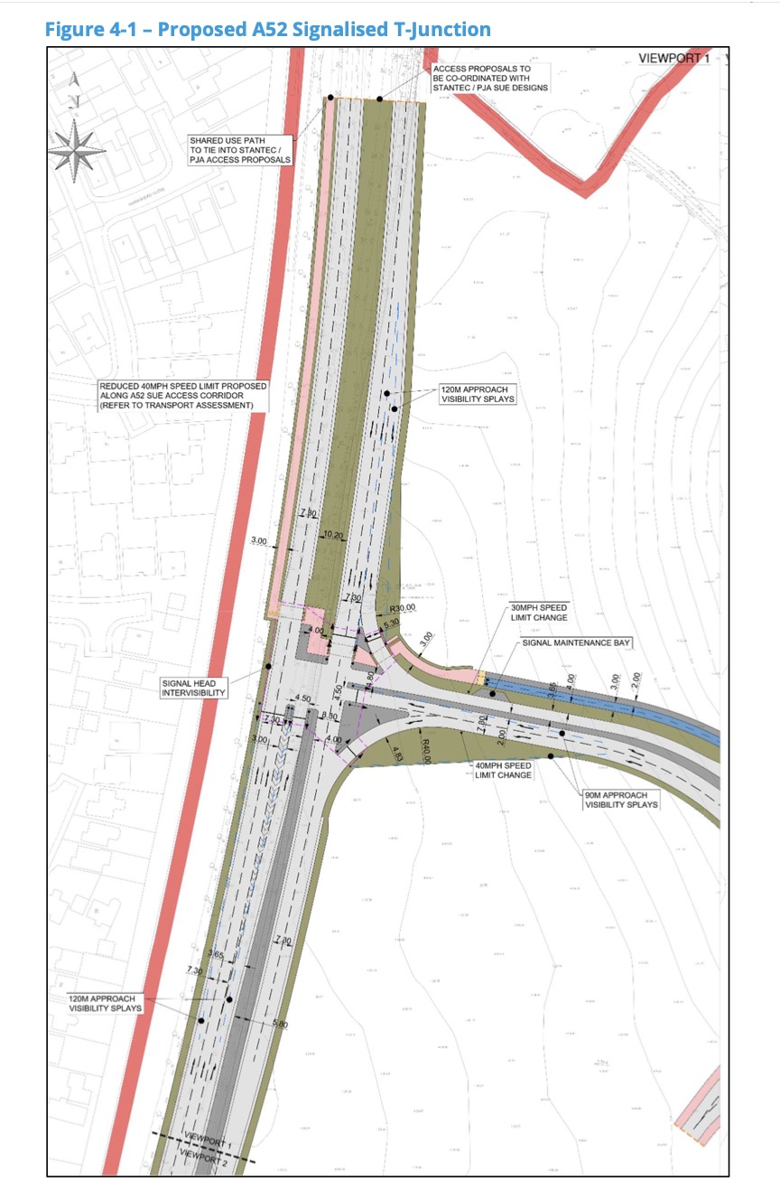
The assessment proposes reducing the speed limit to 40mph along the relevant section of the A52, with the report stating that this has been agreed in principle with Nottinghamshire Police.
Within the county council’s development site, a new four-arm roundabout would connect the residential neighbourhoods, employment land and internal distributor roads.
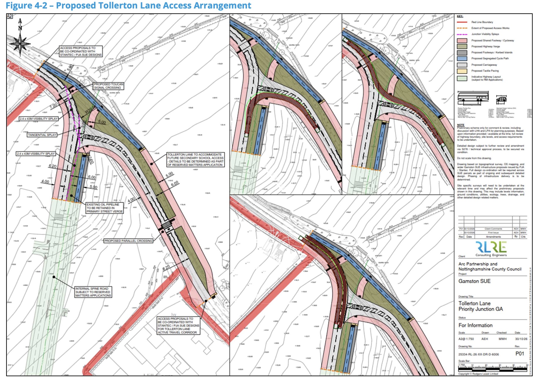
Changes are also proposed where the new development connects with Tollerton Lane.
The plans would alter the road’s priority arrangements, with the main route continuing into the development and a new T-junction providing access towards Tollerton village.
Additional pedestrian crossings, wider shared-use paths and facilities for cyclists are proposed around the planned secondary school site.
The transport assessment also identifies measures intended to prevent traffic generated by the development from travelling through surrounding villages.
A monitoring and management strategy is proposed for Bassingfield Lane, with provision for closure measures if significant rat-running develops.
Similar arrangements are proposed for Tollerton village, including reduced speed limits, traffic-calming features and the possibility of bus gates or road closures if required.
These measures have not been confirmed as final arrangements and would depend on future monitoring and decisions.
Public transport forms another part of the proposals.
The assessment outlines plans to enhance Nottingham City Transport’s route 12 and extend route 6 into the development, with services intended to operate from the earliest stages of occupation.
Bus frequencies would increase as the development progresses, while a future express service connecting the site with Nottingham is also proposed.
Bus stops would be located within approximately 300 metres of homes.
The wider transport strategy also identifies a potential park-and-ride facility at Gamston, with developer contributions towards the scheme.
Two mobility hubs are proposed within the development, potentially providing cycle hire, car clubs, electric vehicle charging and parcel collection facilities.
For pedestrians and cyclists, the proposals include a new bridge over the A52, providing a traffic-free link between the development and Gamston, with onward connections towards West Bridgford.
Improvements are also proposed to existing walking and cycling routes, including connections towards the Waterside Bridge over the River Trent.
The assessment identifies a package of changes to existing A52 crossing points, including upgraded facilities at Bassingfield Lane and the possible closure or diversion of some crossings where alternatives are provided.
Traffic modelling has been undertaken using a forecast year of 2039, when the wider development is assumed to be fully occupied.
The modelling considers up to 4,400 homes, employment space, schools and other facilities, together with the proposed highway improvements and public transport measures.
The assessment acknowledges that the additional development traffic would increase journey times and queuing on some sections of the A52.
However, the consultants conclude that the proposed package of improvements could accommodate the forecast traffic without causing severe residual impacts on the road network.
The report also acknowledges that some existing queuing problems would remain.
Separate modelling of the new junctions serving the county council’s land concludes that they would operate within their theoretical capacity during the morning and evening peak periods in 2039.
At the proposed southern A52 junction, modelling forecasts an average delay of approximately 70 seconds per vehicle equivalent leaving the development during the morning peak, with an average maximum queue equivalent to around 17 passenger cars.
The assessment also identifies further work that has not yet been completed.
Up to 20 junctions outside the main traffic modelling area may require separate capacity assessments, with that work expected to be submitted separately.
The timing of major transport improvements also remains unresolved.
The report states that the delivery and phasing of infrastructure will require agreement between the developers, Rushcliffe Borough Council and Nottinghamshire County Council.
The wider transport strategy has been developed through discussions involving the county council, National Highways and other transport stakeholders.
The council-owned land application forms part of the wider East of Gamston/North of Tollerton strategic development allocation, which has been the subject of separate planning applications by Taylor Wimpey and Barwood Land, and Vistry Group.
Rushcliffe Borough Council will consider the transport assessment alongside the other application documents and consultation responses before determining the planning application.
