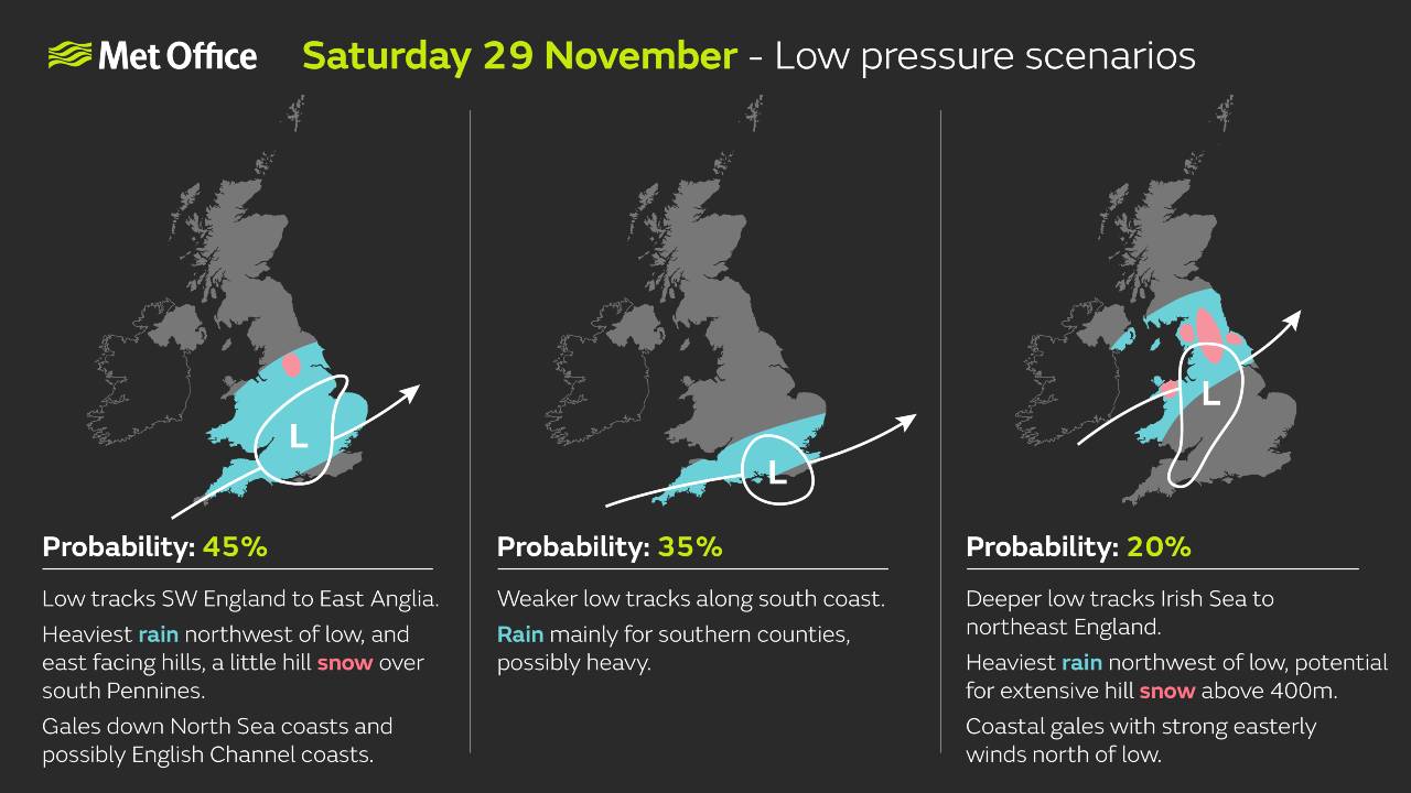
The UK is set for an unsettled spell of weather this weekend as an area of low-pressure approaches from the Atlantic.
This system is expected to bring periods of heavy rain, strong winds and the potential for some impacts across parts of the country.
Met Office Deputy Chief Meteorologist Steven Keates, said: “Confidence is high that the weekend will be unsettled, but there remains some uncertainty over the exact track of the low-pressure system. Small shifts in its path could significantly affect where the heaviest rain and strongest winds occur.
“This means that while some areas may experience disruptive conditions, others could see much less severe impacts. The Met Office is closely monitoring developments and will update forecasts as the situation becomes clearer.”

Ahead of the weekend
A Yellow Wind Warning is in force for parts of western and northern Scotland from 4pm today to 11am tomorrow. Gusts are expected to reach 60–70 mph in exposed coastal locations, with isolated spots possibly exceeding 75 mph at times. These conditions could result in travel disruption and affect outdoor activities. Please check the latest warnings on the Met Office website and app.
Further Ahead
After the weekend system clears, there will be a brief settled period late on Sunday before further wet and windy weather moves in on Monday. Some of this rain is expected to be heavy at times, particularly across western areas. Conditions will remain changeable through next week, with occasional drier spells between weather systems.


