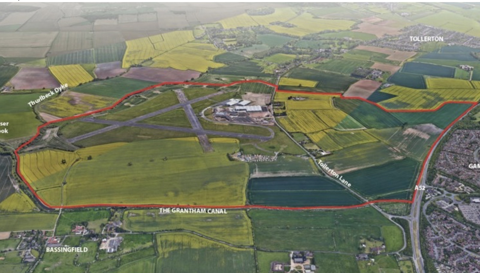
Two areas of elevated radiation have been identified on land forming part of the proposed Gamston and Tollerton development, according to specialist surveys submitted with a new planning application.
The findings relate to land owned by Nottinghamshire County Council, which is seeking outline planning permission for up to 550 homes, employment land, a secondary school site and other facilities within the wider development area.



Three radiological survey reports carried out between June and September 2026 have been submitted as part of the application to Rushcliffe Borough Council.
The investigations were undertaken because of the site’s history as part of the former RAF Tollerton airfield, where aircraft were broken up, burned and buried under a military disposal practice known as “Bash, Burn, Bury”.
The reports identify the possibility of contamination involving radium-226, a radioactive material historically used in luminous paint on aircraft instruments and equipment.

© westbridgfordwire.com
Although the first two surveys found no significant radiological contamination in the areas investigated, a third survey conducted in September identified two locations with elevated radiation readings close to the boundary of Tollerton Park mobile home site.
The highest readings reached 2,079 counts per second, compared with a background reading of approximately 380 counts per second recorded during the survey.
An associated radiation dose rate of 0.5 microsieverts per hour was measured, compared with a background level of 0.07 microsieverts per hour.
The report, prepared by radiological protection specialists Radman Associates for engineering consultants Rodgers Leask, states that the readings were above normal background levels but did not represent a significant exposure risk with the site in its existing condition.

© Lukas Willcocks
Further analysis using gamma spectroscopy identified radium-226 through the detection of radioactive decay products associated with the material.
The report concludes that the findings indicate the potential presence of radiological contamination.
The investigation follows two earlier intrusive surveys, during which specialists monitored material excavated from test pits and boreholes.
The first, carried out on 23 June 2026, involved 11 trial pits across the former airfield land.
No elevated readings were recorded in any of those locations. The report concluded that there was a low risk of radiologically significant contamination being present, while acknowledging that its absence across the entire site could not be guaranteed.
A second intrusive investigation on 1 and 2 September covered 21 locations, including nine trial pits, six window sample boreholes, five concrete cores and a further borehole.
Again, no elevated readings were recorded, with the survey finding no evidence of significant radiological contamination in the surface and made-ground layers of the areas examined.
The third investigation, conducted on 10 and 11 September, used a different approach.
Specialists carried out a walkover survey using radiation monitoring equipment to assess the surface and shallow subsurface across a wider area of the site.
Most of the surveyed land showed no significant radiological contamination, but the two elevated readings were identified towards the northern boundary, near Tollerton Park.
The specialists said the monitoring equipment could assess radiation from the surface and immediately beneath it, but could not rule out contamination buried deeper underground.
The September report states: “Given that the walkover survey reports on activity in surface layers only (~300 mm depth), due to the shielding effect of overburden, the absence of contamination at depth cannot be guaranteed.”
It adds that previous intrusive investigations suggest the risk of deeper contamination is low.
The report recommends further intrusive investigation if the areas with elevated readings are to be developed, to establish the nature and extent of any contamination and determine whether it is subject to environmental permitting regulations.
However, the submitted development plans show that the affected locations are within an area designated as public open space rather than land proposed for buildings.
The report states that these areas will not be subject to development.
The findings are particularly relevant because concerns about possible contamination from the former military airfield have been among the issues raised in opposition to the wider Gamston and Tollerton development proposals.
All three reports acknowledge the history of aircraft disposal at the former RAF site and the potential for radioactive material associated with equipment used during that period.
They also refer to a previous investigation into the incidence of acute myeloid leukaemia at Tollerton Mobile Home Park, undertaken by Rushcliffe Borough Council in September 2008.
The newly submitted reports do not establish any connection between the radiation readings and health conditions among local residents.

The latest findings provide further information about the condition of the land but do not amount to a guarantee that contamination is absent throughout the site.
They also distinguish between the low level of exposure risk identified in the site’s present condition and the need for additional investigation if construction or excavation is proposed in the affected areas.
The radiological reports form part of planning application 26/01891/OUT, submitted on behalf of Nottinghamshire County Council for land east of Gamston and north of Tollerton.
Rushcliffe Borough Council will consider the application and its supporting environmental assessments before determining whether planning permission should be granted.