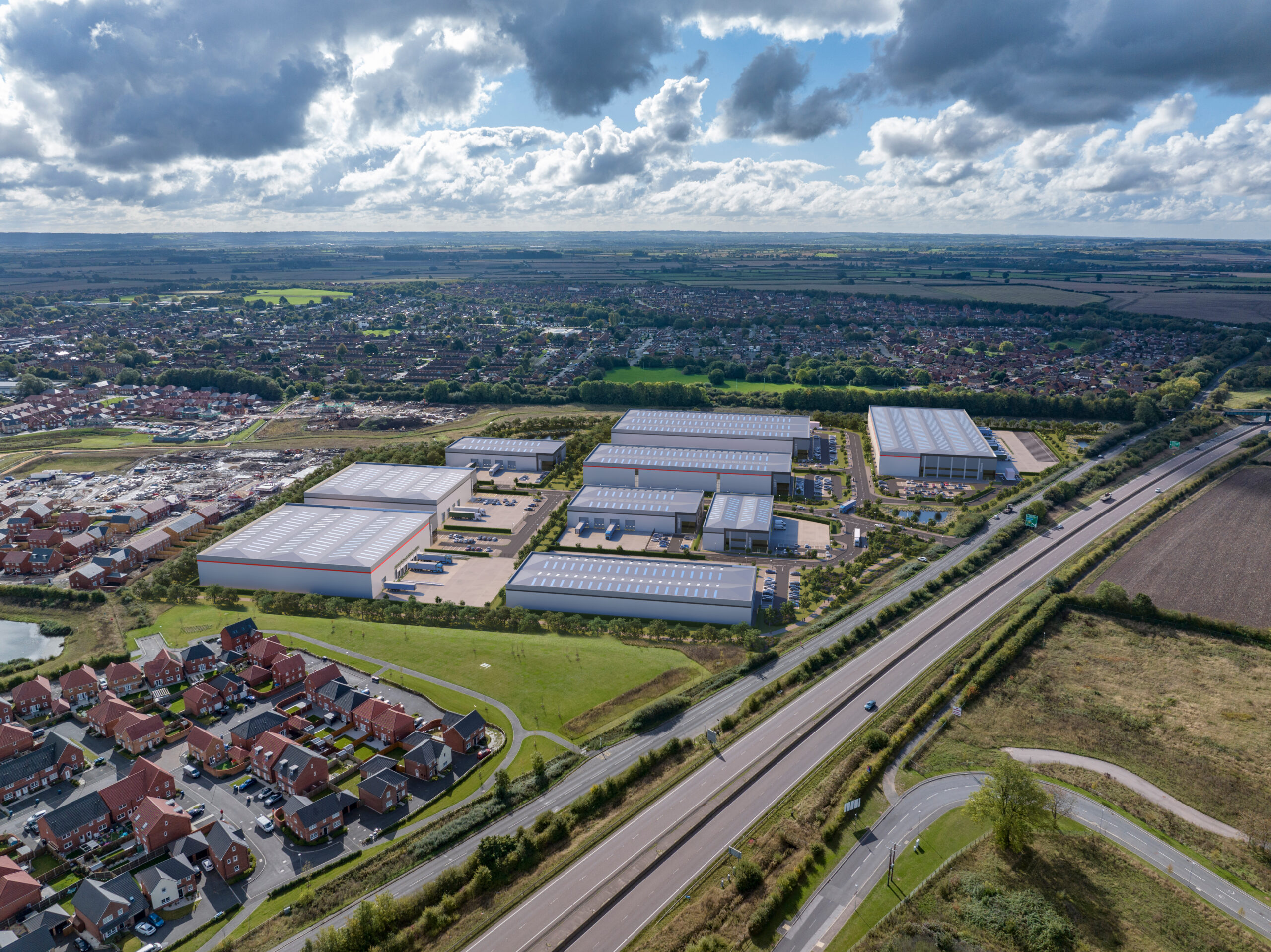
Plans have been submitted for a major employment development beside the A46 at Bingham, which the applicant says could support around 750 full-time jobs.
Rula Developments is seeking permission for up to 55,740 square metres — almost 600,000 sq ft — of employment space on 15.83 hectares of undeveloped farmland at Old Fosse Road.


The site, known as Bingham 46, is about 1.5 miles north-west of Bingham town centre and lies between the A46, the B692 Old Fosse Road and the Nottingham to Grantham railway line.
The hybrid application, reference 26/01245/HYBRID, combines a detailed proposal for the initial infrastructure with an outline application for the wider development.
Full planning permission is being sought for a new access, part of the internal estate road, initial drainage works and landscaping on part of the site.

Outline permission is sought for buildings covering employment uses including offices, research and development, light industry, general industrial operations, storage and distribution. Service yards and other associated works would also be included.
Most details of the employment buildings, including their final appearance, layout and landscaping, have been reserved for consideration through future applications. Access to the site is included in the current proposals, but the internal access arrangements for individual development plots would be decided later.
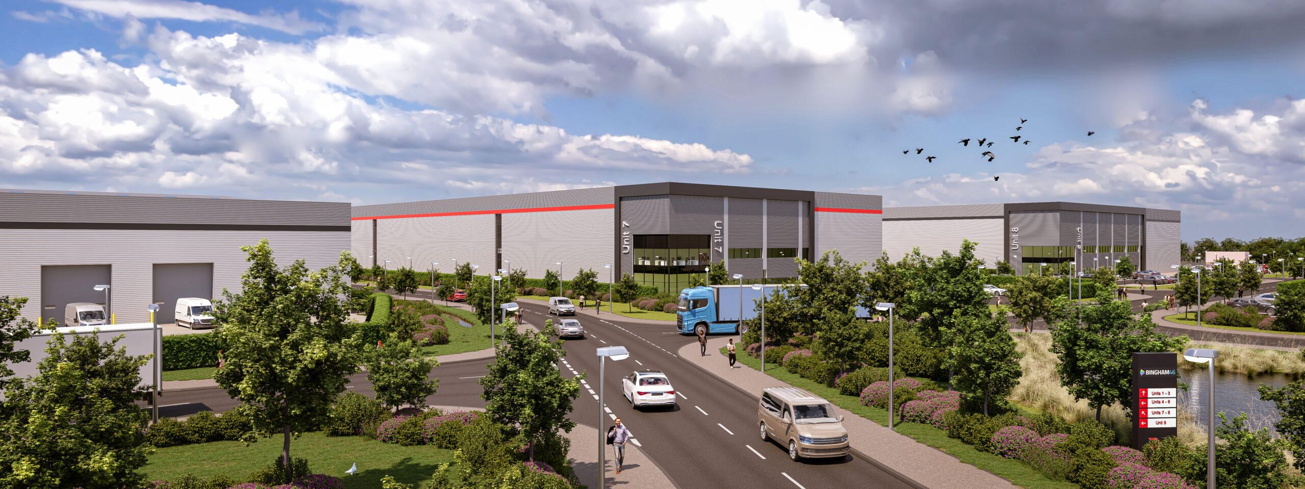
An indicative masterplan shows one way in which eight employment units could be arranged across the land. However, the documents make clear that this layout is illustrative and is not being submitted for approval at this stage.
The application divides the site into two development areas. Buildings on the first plot could reach a maximum of 17.5 metres at the ridge, while those on the second could be up to 21.5 metres.
Rula Developments estimates that the completed development could support around 750 full-time jobs, as well as construction work and additional employment away from the site. The company puts the proposed investment at around £40 million. These figures are the applicant’s estimates and will form part of the council’s assessment of the scheme.
The land has previously been allocated for employment development as part of the wider strategic expansion north of Bingham, which has also delivered substantial new housing.
Rushcliffe Borough Council’s Local Plan, adopted in stages in 2014 and 2019, allocated the wider area for around 1,000 homes, approximately 15.5 hectares of employment land, a neighbourhood centre and community facilities. It specified that storage and distribution development should be concentrated towards the western side of the site, close to the A46.
The emerging Greater Nottingham Strategic Plan continues to identify the site for employment use. Application documents say the housing element of the wider Bingham expansion is expected to be completed by 2028, while development of the employment land is likely to take longer.
The latest application follows an earlier outline permission for the site. According to the submitted design and access statement, the period for lodging reserved matters under that permission ended in December 2025.
Rula Developments submitted a reserved-matters application for access and infrastructure works in September 2025, which was amended in April 2026. The new hybrid application has now been made to retain the proposed employment use of the site while securing detailed permission for the first phase of infrastructure.
Vehicle access would be created directly from Old Fosse Road through a new junction with a right-turn lane. The proposed entrance would have a 7.3-metre-wide carriageway and would be designed to accommodate articulated lorries.
The applicant’s transport assessment concludes that the junction would operate with negligible queues or delays. It also states that predicted morning and evening peak traffic would be slightly lower than the levels assessed for the wider development in 2010.
A public bridleway running across the land would be diverted around the proposed sustainable drainage features but would continue to cross the site from north-west to south-east. It would provide a route for walkers, cyclists and horse riders, separated from the estate road by landscaping and a drainage swale.
Three-metre-wide pedestrian and cycle routes are proposed alongside the internal roads as individual plots are developed. Cycle parking, showers and changing facilities would also be expected within each development plot.
The documents state that suitable public transport access remains the subject of discussions with Nottinghamshire County Council’s public transport team.
Most of the site is within the lowest category of flood risk. Surface water would be managed through sustainable drainage features designed to cope with a one-in-100-year rainfall event, with an allowance for climate change. Water would ultimately be discharged into the Carr Dyke at a controlled rate.
The initial works would require the removal of sections of three hedgerows assessed by the applicant’s arboricultural consultant as being of low quality. Other trees and hedgerows within the detailed application area would be retained and protected during construction.
Further vegetation could be affected when the wider employment plots are developed, although the exact impact would depend on the layouts submitted at the reserved-matters stage. Replacement trees, hedgerows, native grassland and wetland planting are proposed as mitigation.
A landscaped bund containing native trees and shrubs would run around the northern and eastern sides of the development to provide screening from neighbouring land.
Rushcliffe Borough Council has not yet decided the application. If outline permission is granted, it would approve the principle and maximum scale of the employment development, but further reserved-matters applications would be required before the individual buildings could proceed.
